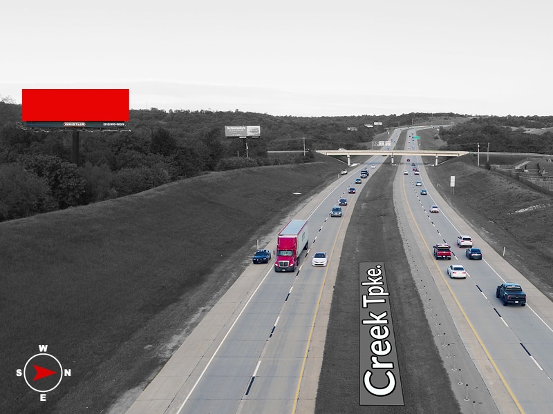
LOCATION
Sign Number: US-14 E
Corridor: Sapulpa
Intersection: Hwy 75 & SH-364 (Creek Turnpike)
Driving Directions: South side of SH-364 (Creek Turnpike) Extension, .7 miles West of Hwy 75
Latitude / Longitude: 36° 0’30.48″N , 96° 1’26.58″W
Google Maps Latitude / Longitude: 36.0086263 , -96.0241506
Side of Highway: South
Facing: East
Direction of Traffic: West bound traffic
Read: Left Hand Read
CORRIDOR
DMA: Tulsa
Avg Daily Traffic Count (source): OTA: Creek Turnpike = 22,140
Primary Suburb Corridor Population: 20,432
County: Tulsa
Average Household Income: $65,189
Zipcode: 74066
Primary Corridor Zipcode(s): 74066
Zipcodes in proximity::74037, 74033, 74047, 74132, ,
ADDITIONAL INFO
Primary Retail: Walmart Supercenter
Primary School District(s): Sapulpa Public Schools
Primary Entertainment:
Primary Healthcare: Ascension St. John Hospital Sapulpa, Oklahoma Heart Institute Sapulpa, Sapulpa Indian Health Center
AUDIENCE
Daily Traffic Count: 22,140
DEC (Daily Effective Circulation) *: 36,088
GRP (Suburb / Corridor) *: 177
GRP (DMA) *: Sapulpa
Weekly Impressions: 252,617
4-Week Impressions: 1,010,470
Monthly Impressions: 1,082,646
* Daily Effective Circulation (D.E.C.) is the average number of passers-by or persons (18+ years) in cars or other vehicles, that could potentially be exposed to an advertising display or billboard for either 12 hours (unilluminated – 6:00am to 6:00pm) or 18 hours (illuminated – 6:00am to 12:00 midnight) on an average day.
* Gross Rating Points (GRP) are the total number of in-market impressions delivered by an Out of Home (OOH) or outdoor billboard campaign schedule expressed as a percentage of a market population and is a measure of advertising impact.
PRODUCT
Product Type: Bulletin Size: 14×48
Product Advantages: Always On – Reach 100% of the daily audience with creative that can be extended outside of the box.
Illumination: Yes
Spots per Loop:
Dwell Time:
Frequencies per 24-Hour Period:
Hwy 75 & SH-364 (Creek Turnpike)
Daily Traffic – 22,140
14×48 – Bulletin

